This is a slideshow from 2015 advocating for the International Appalachian Trail in Portgual. Interestingly, they refer to the Appalachian Trail as an American “brand” and the IAT as a “prestigious brand.”


This is a slideshow from 2015 advocating for the International Appalachian Trail in Portgual. Interestingly, they refer to the Appalachian Trail as an American “brand” and the IAT as a “prestigious brand.”
Over the past few weeks, I’ve been looking for ways to be helpful to others, which is a new experience for me. At first I joked that it was a way of improving my karma, since I’m trying to buy a house. But karma doesn’t work that way.
As Krishna says to Arjuna in Chapter Three of the Bhagavad-Gita, “Strive constantly to serve the welfare of the world; by devotion to selfless work one attains the supreme goal of life. Do your work with the welfare of others always in mind.”

While helping a friend move mid-May we drove an hour back and forth through the countryside and I passed a sign bearing a verse that I’d never encountered, though raised Baptist. It too echoed what I was thinking about in the Gita, but came from Paul’s Epistle to the Galations: “Be not weary in well doing.”

I cannot claim to have ever done work so selflessly, or without complaint. In fact, my desire to hike the trail had a corollary selfish motivation; I wanted to run away from the anonymous “other people” I encounter every day. I wanted to escape our current political climate. Perhaps I also wanted to shirk the tasks of maintaining a household. However, living in someone else’s house combined with parenting a near-adult led me to consider what the true path of this summer might be.
Trying to make a new home come together compelled me to find ways to spend my newly opened schedule. I wanted my new days to be meaningful; perhaps they could even be as worthwhile as hiking the Appalachian Trail had been. And so we come to the reason for this post: sorting out what selfless work is and what it means to be engaged in well doing.

A trail friend I’d met in Georgia needed transportation from Gatlinburg to Davenport Gap, so I drove down to help her and two other hikers get back to the trail. A friend of several years was moving, so I helped drive and carry boxes for three days. It felt good to be useful, and her gratitude made my heart soften in unexpected ways.

Later that same week, several hiking friends needed rides to Trail Days in Damascus, and many of them had made it as far as Erwin, Tennessee. Erwin is a fifteen-minute jaunt for me by car, and Damascus is an hour ride up the road. But I had promised them I’d help once they made it past Max Patch.

I know most of the roads and gaps between Max Patch and Damascus, and I often call this my home area. I am grateful to have backpacked nearly all of the miles in this section and was thrilled that folks I met in Georgia were getting ready to pass through for the first time.


Trail Days is quite possibly the biggest event involving the Appalachian Trail (AT) that happens close to where I live. I usually try to make it up for the parade, and this year was no exception, especially since I was taking Low Gear, On Star, and Eric back to Erwin afterward. (Click here for a brief clip as the class of 2018 walks by.)


Every year Damascus hosts a gargantuan celebration of the Trail with vendors, hiking celebrities, and services catering to thru-hikers, but exciting for anyone in love with the AT.

Tent City, where the hikers make their home during Trail Days, is home to a variety of tribes, such as the Trash People and Riff Raff, the oldest and rowdiest. After speaking with a couple of trail friends, I’m still a bit in the dark about how the groups stack up with each other, but then, I think these are intricacies of the thru-hiking experience that you only gain if you stay with the hiker trash bubble as it makes its way north to Katahdin.

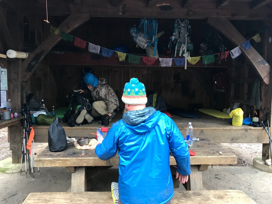
My first introduction to any AT tribe came at Plumorchard Shelter in Georgia on the coldest night of my April hike when I met “Tune-Up.” A spokesperson and leader for the Trash People, Tune-Up explained that the Trash People regularly pack out trash to preserve the trail and generally try to keep a good vibe going. He hung prayer flags inside the shelter, commenting that the Appalachian Trail Conservancy (ATC) frowns on the practice.

That evening I learned that the ATC is not universally revered by the thru-hiking community, and it opened a number of questions for me that I’ll be working out for years to come.
Around the fire, he spoke in glowing tones about Miss Janet of Erwin, whom most thru-hikers know either directly or indirectly to be a saint of the trail, the Trail Angel of all trail angels. The closest I came to her was picking up Ron Rico from her house on the way to Damascus, and from the car I saw hikers mulling about on her carport, several in fact I remembered from weeks before at Plumorchard, Tune-Up among them.
Over the days I shuttled hikers to Damascus (and those preceding) I experienced frequent realizations that I was not on the trail anymore, that I was no longer hiker trash (smelled too good for that!) and that I could no longer lay claim to belonging in a community that had moved on from Franklin, NC after I had left it.
It was humbling, but also ratcheted up my respect for thru-hikers, and helped me sort out how my next hike would play out, if I could be fortunate enough to hit the Trail again in years to come. (Section hiking is as good as it gets for now, but I’m hankering for the whole enchilada once my kid takes flight into college.)
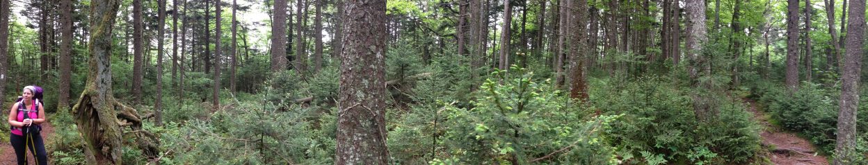
It’s hard to explain what the appeal is to people who know nothing about the Trail, have never experienced the thrill of knowing that everything you need to make it for a few days is in a backpack that you carry everywhere you go. The peace that I find when I’m in the deep woods is incomparable. When I’m there I trust that the Trail will provide all that I need, and only when it is time.
Off the trail, I am reminded that every day we are given opportunities to help others realize their dreams, to serve a force beyond ourselves, which inevitably sustains all beings. Still trying to work out what selfless means in this context, when it feels so good to be helpful and when my own life is made better as a result.

This was the post I dreaded from Day 1, and knew I would need the courage to write: the plan not executed, the plan so perfectly laid.
After everything, the moment when every piece of gear in my pack is necessary, when every fault has been found and repaired or replaced. The food has been separated into plastic bags and mail drops are ready to go to the post office; reservations have been made and weeks of hiking plotted.
Family and friends have been notified that this NOBO (northbound hiker) is now a SOBO, once she makes it to Harper’s Ferry, the symbolic near-halfway point of the Appalachian Trail. I had even decided on where to eat breakfast while waiting on the Appalachian Trail Museum to open on Tuesday morning.

I cried myself to sleep for three days once I knew my path was diverging from the Trail. The morning after those three days I was calm, as if I had accepted the death of a loved one. I decided it was like a death, those nights when I lay quietly trying to conceal my weeping. What was I crying for? Who was I mourning if not that other “me,” the one without responsibilities, with no schedule except the one that indicated maildrops and shelters?
The truth is, I woke up after those three days with a deeper sense of my real direction, moving forward. I had been naively imagining certain parts of my life to be separate and distinct from one another. I had compartmentalized my “trail life” from my “home life.” My kid said I was using my frequent road rage as a way to justify going back on the trail, or vice versa. I was going to sleep at 7:30pm, like I did when I was in a tent. There was a wildness about everything I did, and I was obsessed with the weights of things.
Frequently I packed and unpacked my pack, eager to be heading out again.
I wasn’t coping with being back home, partly because we weren’t really at home, but staying with my kid’s father. Three cats and three adult-sized persons were inhabiting a small home and it was hard to move around since our stuff lined the walls, filled the garage, or was stacked in boxes around the bed.
I shared that bed with my child, not really a child, and the cats piled in too. My pack was beside the bed, and every night I pored over my hiking calendar, deciding how often I could stop, wanting to clear most of Virginia in 40 days. And I would have done it . . . I know I would have.
But practically, I began to also look at our housing options when I came back. Though I planned to move us closer to the college where I taught (and where my fifteen-year-old was also completing their first semester) it was clear that pickings were slim. The reality sunk in, that we had to buy a home, given that we had two cats and very little money for pet deposits and $700 monthly rents. A mortgage would be half that, provided we could find the right house.
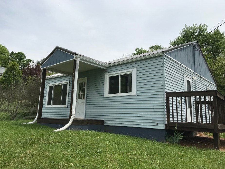
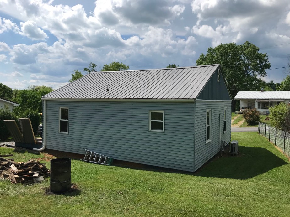
Fortunately, a good friend of mine had been working on the perfect house, a petite cottage close to the college and just the right size. Its modest stature and sunny windows appealed to me, and so I began the difficult process of trying to buy a home.
As the first day of realization turned into the second day, I knew that this was the right thing to do, and that my kid came first.
It was hard living with other people. It had been hard renting for a year while trying to sell my house that we had lived in for almost ten years. Here I was, preparing to commit once again to a house and mortgage, but for all of the best reasons.
It was time for me to accept that the trail would wait, but that my kid would not be fifteen forever. Their success in college was partly dependent on my finding us a reliable, affordable home where we could stay until finished they school, and there was no reason to commute more than the ten minutes this little blue house was away from our school.
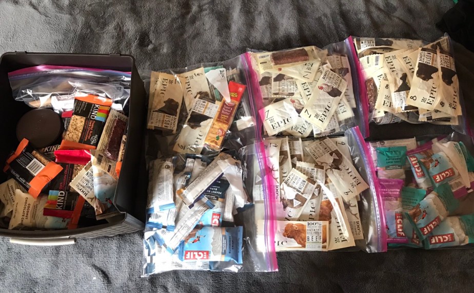
This morning I pulled all of my maildrop bags out the boxes so that we could organize the Epic and Clif bars by expiration date. My kid agreed to go on a backpacking trip with me–the first ever–and there will be many day hikes. We will have plenty of snacks.
I have texted all of my hiking friends to let them know I will be home when they pass through the area, and I can shuttle them to town or take them to Trail Days.
I have told my Dean that I am around this summer so my work as a new Chair can begin in July, on schedule.
My kid and I are going to the beach with my aunt and uncle, the same beach my family has visited since my father was a child.
I am thinking about volunteering at The Nelsonville Music Festival so I can see George Clinton & Parliament Funkadelic, The Decemberists, Ani DiFranco, Tune-Yards, Wooden Shjips . . .
I will be able to work on preparing my manuscript for publication, deadline end of July.
Most importantly, I will be able to snuggle these cats:


Every day now, I go to my office and talk to loan officers and work on planning my classes.
I let go a little more. I know this is the right way to be.
The trail is wherever I put one foot in front of another. It is wherever I begin, each morning.
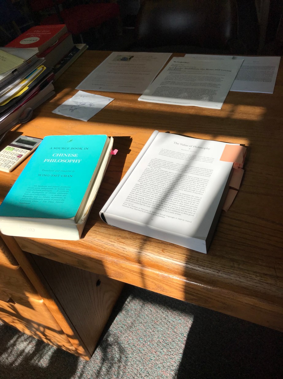
Tonight, while waiting and hoping that this house purchase goes through, I ponder which book I shall read first. For the first time in two years I am not reading about the trail, but instead choosing books from my shelf that I’ve wanted to read for months (or years).
When it is time, I will begin again. And fortunately, I will know what to take, what to leave, and where I’m headed.
Best of all, I will know that I have a home to come back to that fits two adult-sized persons, two cats, and an indeterminate number of books worth finishing.
: :
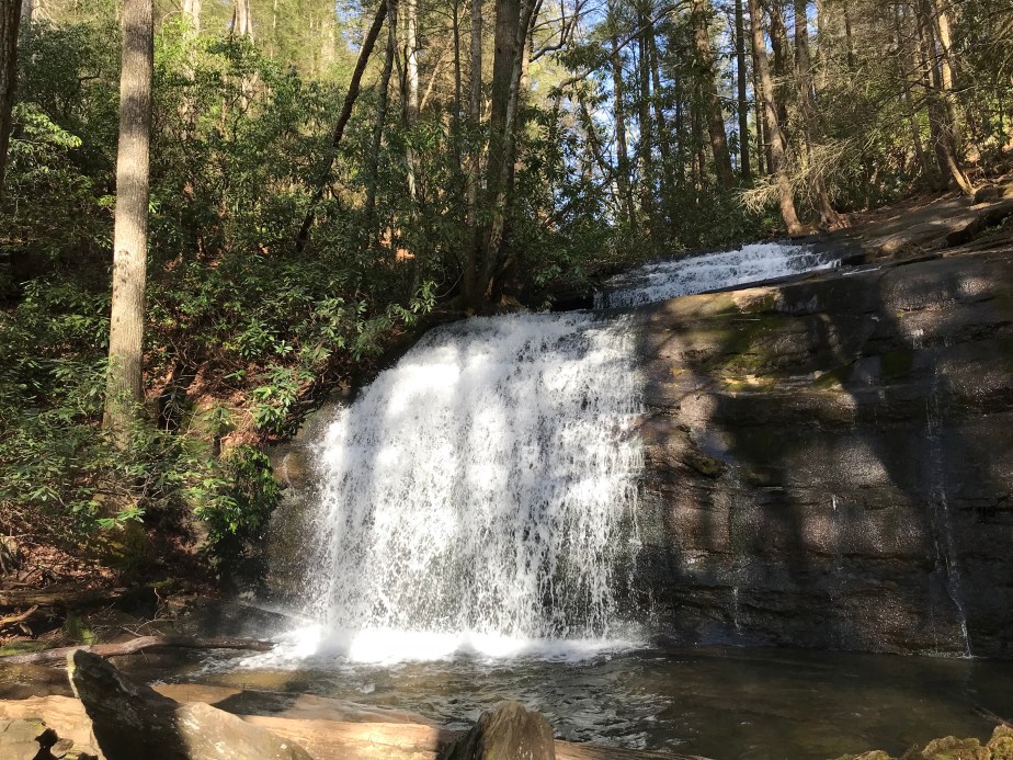
Dick’s Creek Gap to Standing Indian Shelter : April 16 – 17, 2018 for 16.7 miles
This fielding is only for two days because they are a landmark for me in terms of the social aspect of the trail. Even though I had begun as a solo hiker, I had met up with three other hikers who were, for the first ten days of my hike, people I could count on to camp with and to share rides into town with.
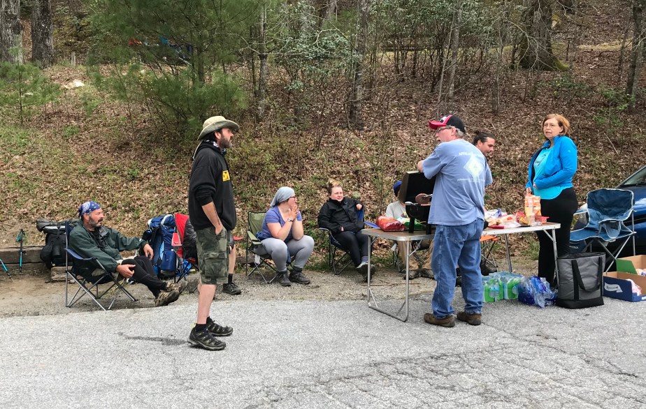
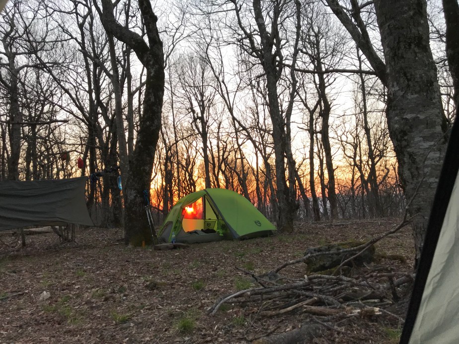
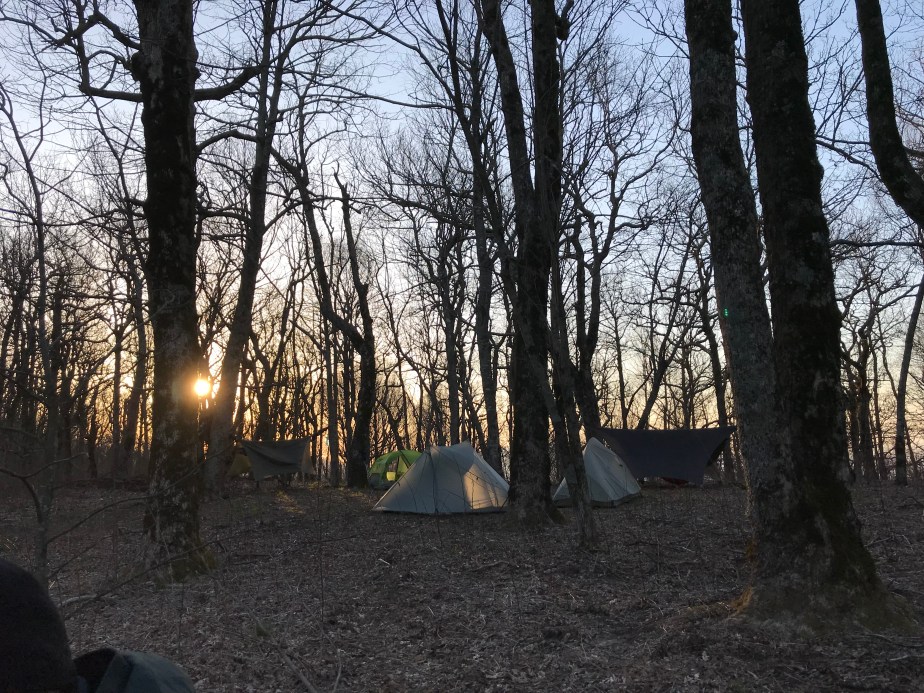
The AT hiking bubble is constantly evolving as people come on and go off the trail. In the photo below, a man and woman (to the right) set up a grill and cook hamburgers and hot dogs for hungry hikers. (This is called “Trail Magic” when people help hikers by feeding them or transporting them for free.)
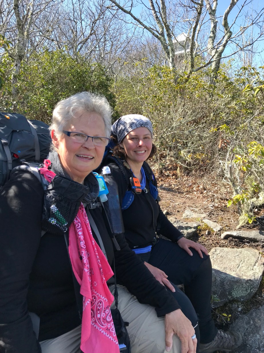
But more significantly, this photo captures some of the people who had stopped at Dick’s Creek Gap on April 14 who were also coming off the trail that day. On the far left is “Ron Rico Suave,” one of my hiking friends. I don’t know the guy in the black sweatshirt. The girl with the grey head wrap is “Low Gear,” whom I’d later enjoy hiking with, and share a room in Franklin with. The blonde girl in black is “On Star,” who was the most organized hiker among us and who always knew where we were (hence her name.)
“Ron Rico Suave,” along with “On Star” and “The Finder” had always hiked faster than me, so often they would make it to camp an hour before and be set up by the time I arrived. On our first day back on the trail from Helen, Georgia, they all agreed they were trying to make miles, and I had a feeling that meant we were about to separate.
Here’s The Finder (left) and On Star (right) in the back of the van we traveled in to the Top of Georgia Hostel, where On Star had a restock package waiting for her. We all walked up to rejoin the trail which was a half mile away. From that point on, they hiked forward and I took my old sweet time.

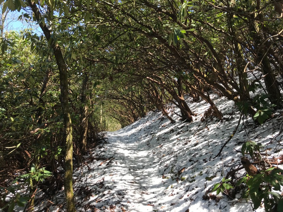
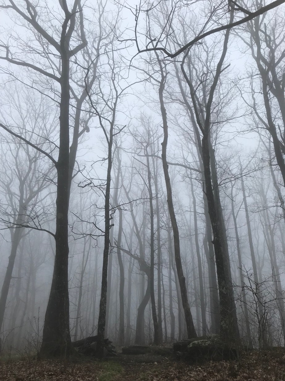
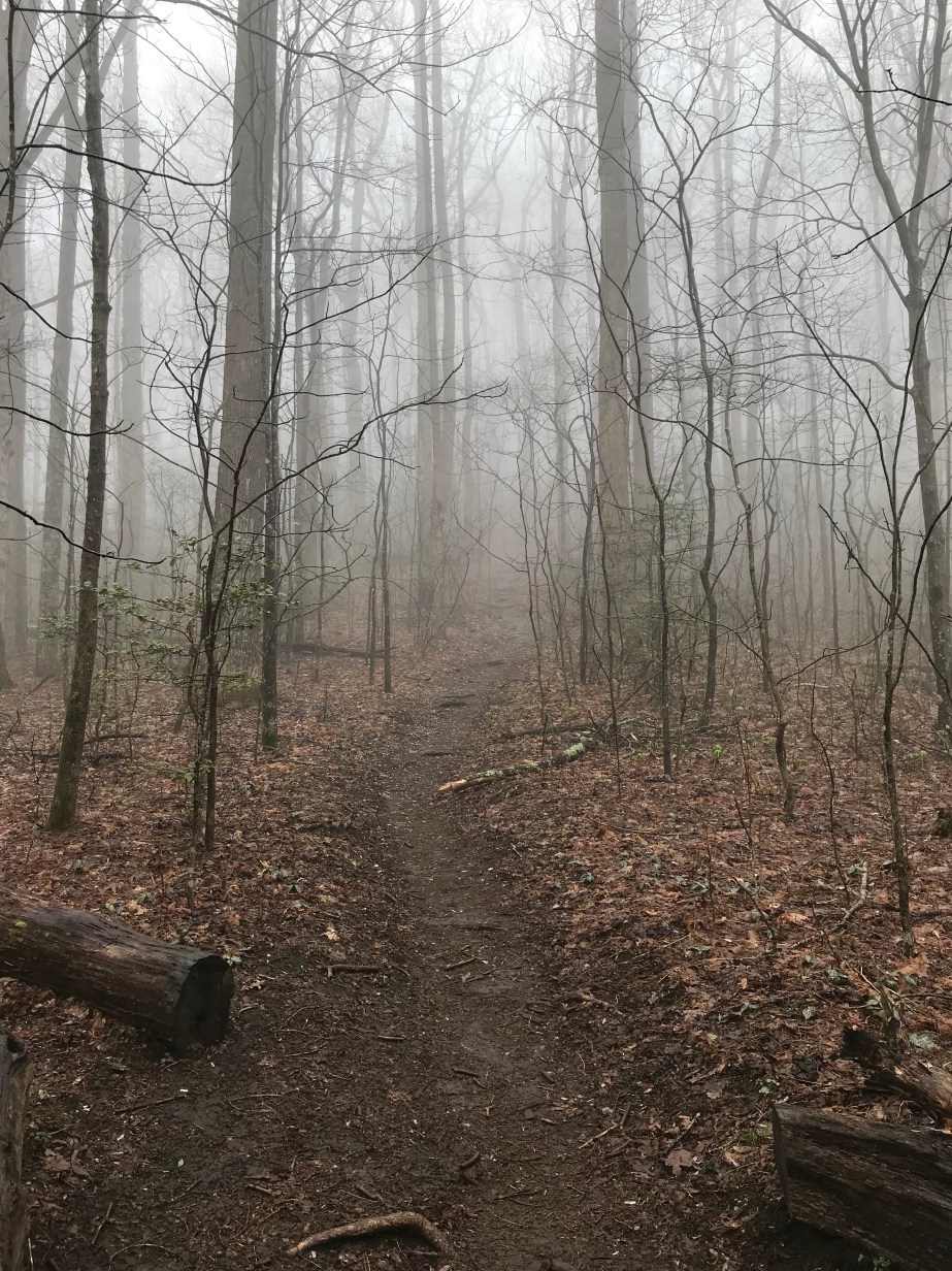
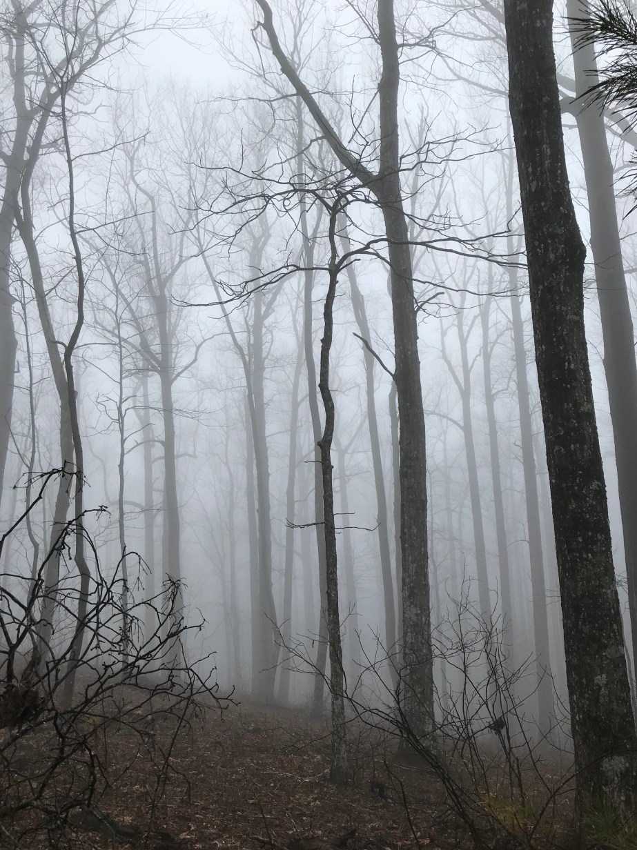
Day 11 – Monday, April 16 – Dick’s Creek Gap to Plumorchard Gap Shelter (4.5 miles, 73.5 miles from Springer)
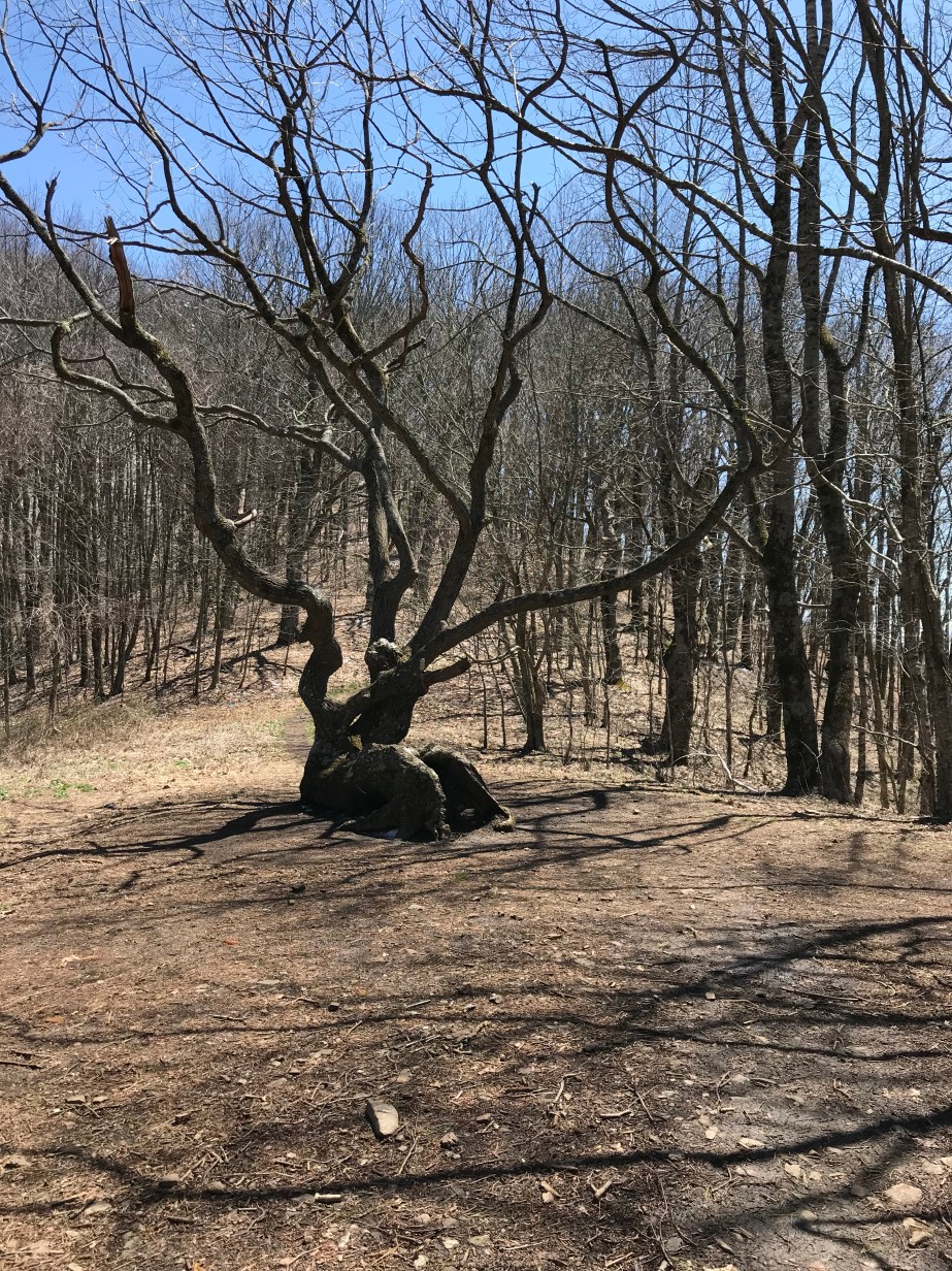
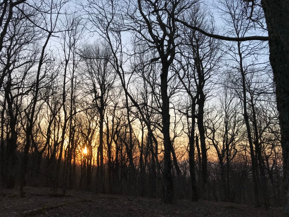
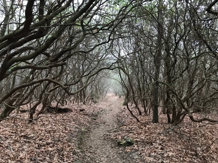
The hike this day was especially cold and windy. The trees were coated in snow and ice which made for beautiful scenery.
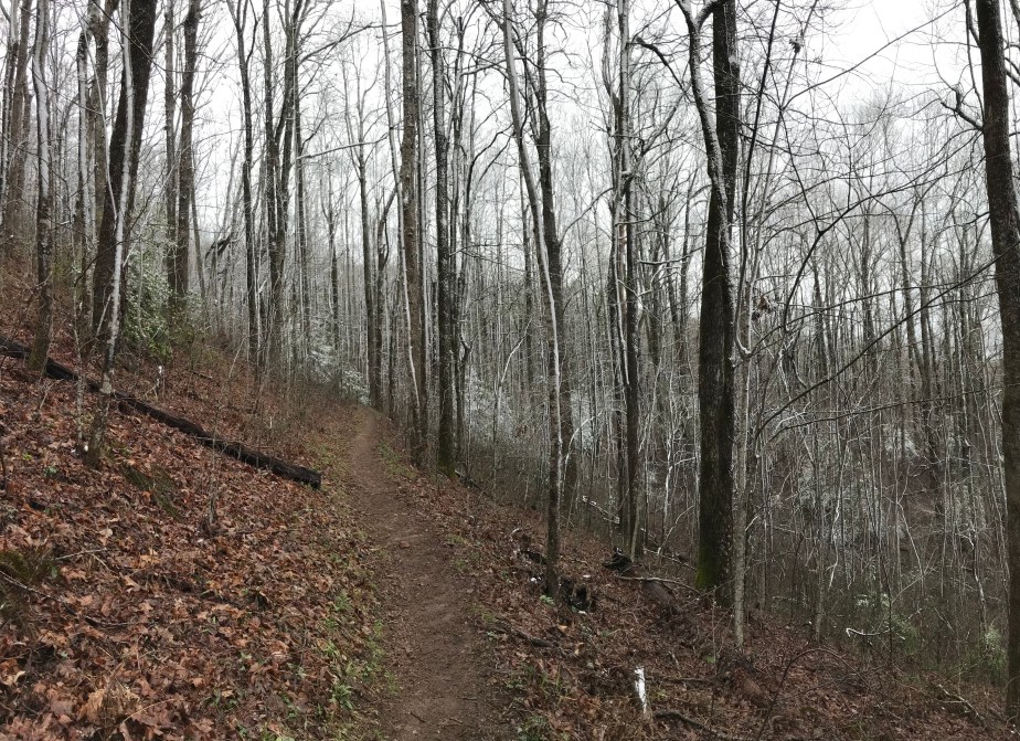


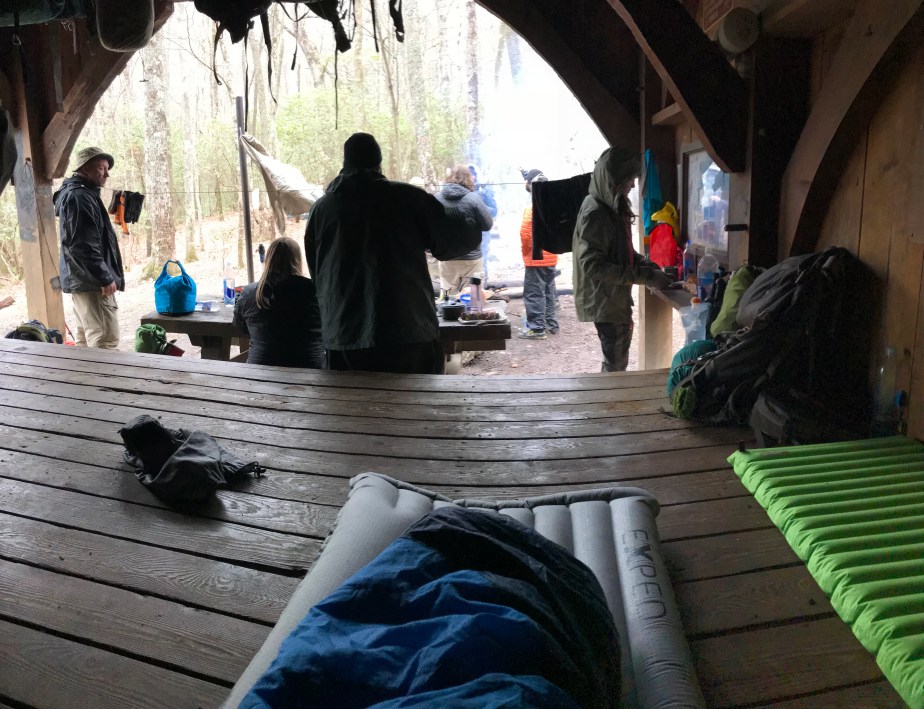
The shelter that night was startlingly cold, probably somewhere in the 20s. If it had not been for the fire, I would have shivered all night. We all opted to sleep inside the shelter, though in hindsight, I would have preferred the nominal warmth of a windless tent.
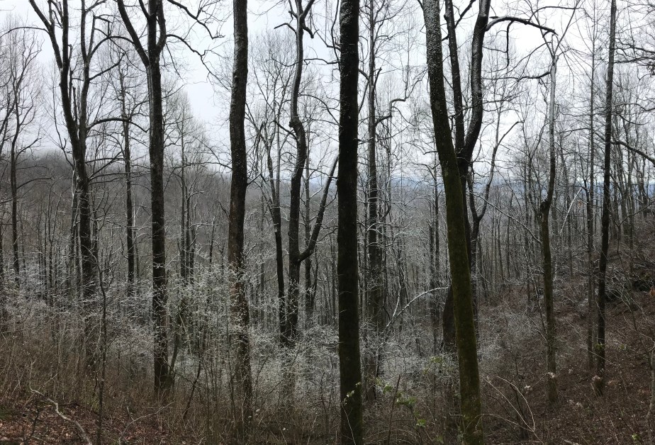
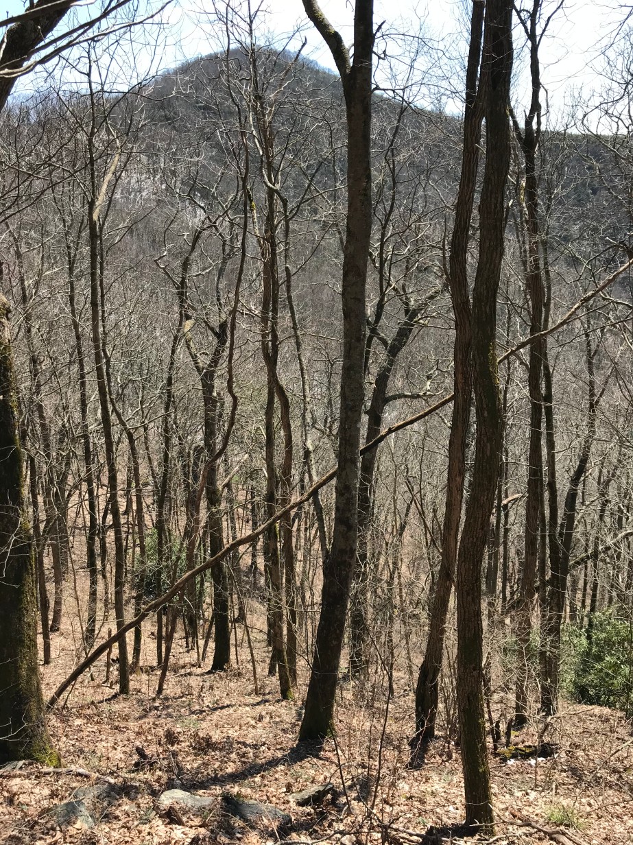
Day 12 – Tuesday, April 17 – Plumorchard Gap Shelter to Standing Indian Shelter (12.2 miles, 85.7 miles from Springer)
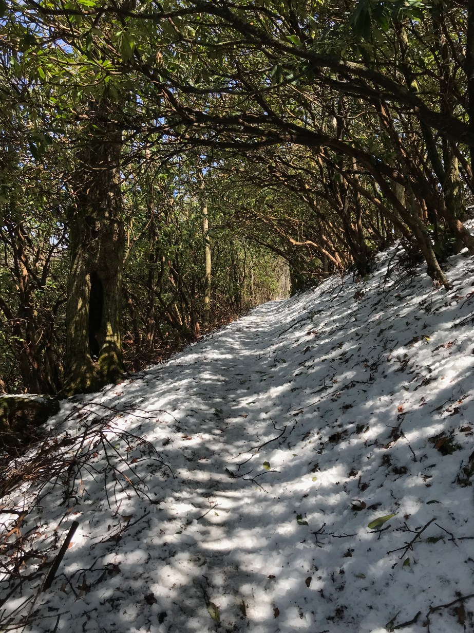
The next day was slightly warmer, although the remnants of ice (that had fallen from the trees that morning) were everywhere to be seen. Because I hiked more slowly than others, I was mercifully spared the pelting that others received as a result of the ice falling from the warming trees.


The part of the story that you aren’t getting is how I came to hike my longest day so far. My friends and I had agreed to hike to Muskrat Creek Shelter and stay for the night, but when I arrived, I realized they had hiked on.
It had been a gorgeous day for hiking and I just imagined that they had arrived at Muskrat Creek Shelter (nothing to write home about) and had decided to make the most of good weather and hike on. I did the same, but pushed myself beyond my comfort.
I arrived at Standing Indian Shelter late with the encouragement of a hiker named Overkill who was moving at the same pace I was. He got his name because he had started his hike with upwards of 80 lbs in his pack. He carried a shower (!) along with other things most thru-hikers abandon days into their hikes.
My friends looked at me piteously when I rolled in, and I don’t think I ate dinner, just set up camp and went to bed. The next morning I decided that if they hiked on again it was for the best, since I didn’t want to keep them from making it to Maine. I had already accepted that I wasn’t going to have time to make it that far, so I did not want to hold anyone back.
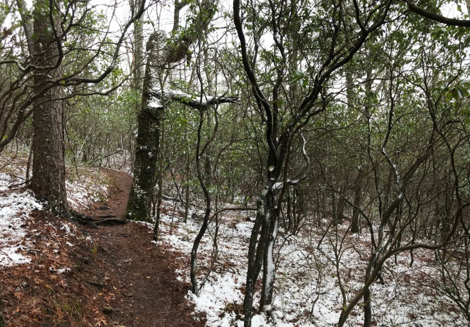
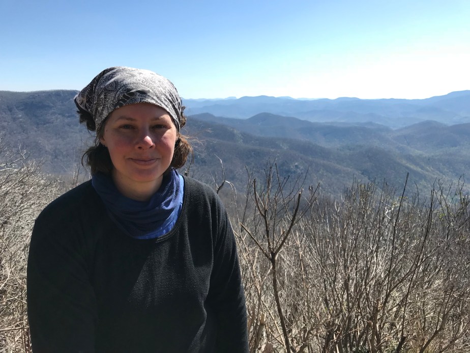
Standing Indian Shelter to Winding Stair Gap : April 18 – 20, 2018 for 23.5 miles
These days marked a transition for me, from hiking to where my trail friends were camped to hiking the miles I wanted to hike for that day and trusting that I’d find a new community. I was not disappointed.
After leaving Standing Indian Shelter, a hiker named Low Gear soon began to overtake me, and although we knew each other, we had never tried to hike together. It turned out that she was an excellent person to hike with.
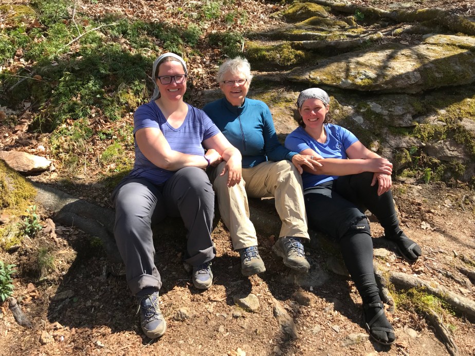
Although she was determined to maintain her solo hiker status (a point which I truly understand and respect) she was fun to talk to and the miles flew by. We began to also have multiple encounters with another hiker named Pacifier who had been posting videos of her hike to YouTube since March. The three of us ended up camping together at Carter Gap Shelter and would spend the next two days after that hiking out to Winding Stair Gap.
I am immensely grateful for the companionship that both women offered. My other friends had hiked on ahead of us, and I would see them again when we came off the trail in Franklin, NC. But for those last three days on the trail before coming off, I was glad to get to know Pacifier and Low Gear better, and to hike with people instead of alone.
Day 13 – Wednesday, April 18 – Standing Indian Shelter to Carter Gap Shelter (7.6 miles, 93.3 miles from Springer)


Day 14 – Thursday, April 19 – Carter Gap Shelter to Long Branch Shelter (8.7 miles, 102 miles from Springer)
On this day, when we left Carter Gap Shelter, Pacifier hiked with us. We all traveled at the same pace and took breaks together.


Day 15 – Friday, April 20 – Long Branch Shelter to Winding Stair Gap (7.2 miles, 109.2 miles from Springer)


On April 21st I came off the trail to catch up on some work and see my family. Hopefully it won’t be long before I return to hiking and am able to catch up with my friends on the trail.
Neel Gap to Dick’s Creek Gap : April 10 – 14, 2018 for 37.9 total miles
Day 6 – Tuesday, April 10 – Neel Gap to Low Gap Shelter (11.5 miles, 42.6 miles from Springer)
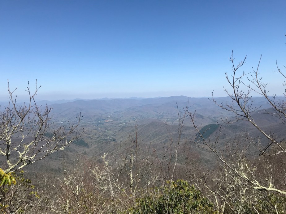
The view below is from Cowrock Mountain, 36.2 miles from Springer.

On the sixth day, I hiked past my friends by accident because of a miscommunication. They opted for a shelter that was over a mile off trail and downhill. I came to the cutoff for the shelter and realized I wasn’t sure if they were there or not, and decided I’d rather hike more miles on trail than waste miles off. It turned out to be a good decision since they had a climb out and a longer next day as a result. I was so tired when I came into Low Gap that I just skipped dinner and went directly to sleep. It was my lowest morale moment on the trail so far and I was lonely, slept badly, and missed my friends.
Taylor, trailname “On Star,” showed up the next morning and my hope was renewed that I was in contact with my friends again. We all hiked (separately, since I am slow) to Blue Mountain Shelter. It was a long day for them, but a moderate day for me.
Day 7 – Low Gap Shelter to Blue Mountain Shelter (7.3 miles, 49.9 miles from Springer)
Below is the sunrise view from Blue Mountain Shelter around 7:30am on Day 8.

Day 8 – Thursday, April 12 – Blue Mountain Shelter to Tray Mountain Shelter (8.1 miles, 58 miles from Springer)
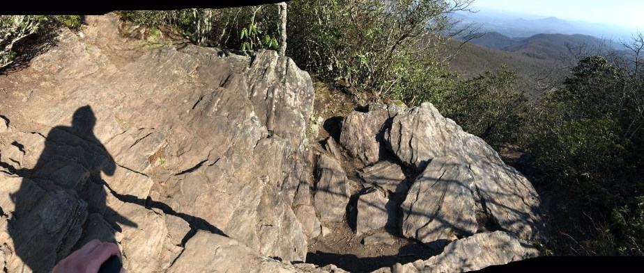
This day was fairly hard with some difficult climbs, especially up Tray Mountain. I used my umbrella as much as I could to protect against the sun, but the wind was also strong that day. I began to enjoy taking pictures of my shadow, since they seemed to capture a side of my life on the trail (and off) that felt otherworldly, significantly solo.


When I reached camp, everyone else was set up already. As soon as the sun went down, the wind began to howl and whip everyone’s tent or hammock wildly. I spent most of the night praying I wouldn’t be swept away. Everyone had dust in their gear the next morning.
Day 9 – Friday, April 13 – Tray Mountain Shelter to Deep Gap Shelter (7.4 miles, 65.4 miles from Springer)
Because of my umbrella, I earned the trail name “Mary Poppins,” which I accepted in lieu of something worse. My friends had been calling me “Rogue” because of my digging tool I carried, but it didn’t exactly fit. The umbrella was for the sun mostly, and the flowers are evidence of the burgeoning spring.


Day 10 – Saturday, April 14 – Deep Gap Shelter to Dick’s Creek Gap (3.6 miles, 69 miles from Springer)
This day was a hike out, so we were gratefully headed to town for restock and rest. Bad weather was moving in, so this was also our chance to avoid potential rain, storms, and snow.
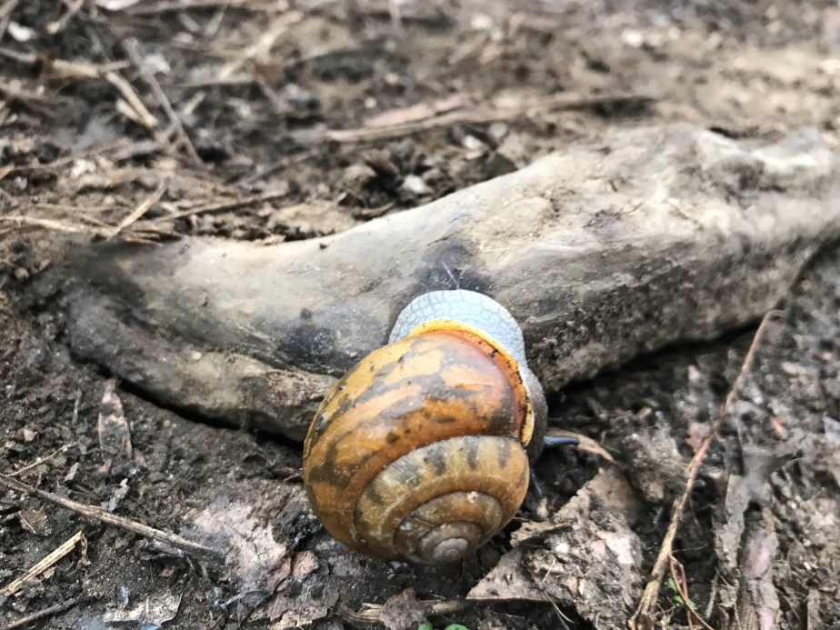
A snail I happened to see while coming off the mountain.
We opted for the touristy Bavarian town of Helen, Georgia over the nearby Hiawassee, largely because we had heard it was hard to find a room. It turned out that Helen was an ideal place to recuperate with fine German food and atmosphere. Oddly enough, there was also a Cabbage Patch Doll Convention in nearby Cleveland, GA, so many of the rooms in our hotel were filled with Cabbage Patch Kids and their enthusiasts.


The clown had to be the strangest I’d seen . . . nightmare material.

We had dined upstairs at Old Heidelberg under the yellow umbrellas.

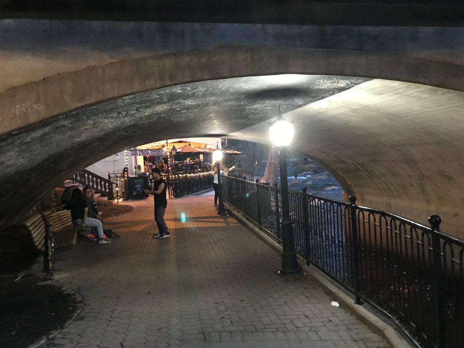
Below, the “Troll Tavern” can be seen below the bridge. Really a fun town with some interesting spaces.
Flowers were some of the most beautiful I’ve seen.

Sunday, April 15 – ZERO DAY
(Glad it was a zero day because the German beer was a bit much on my stomach which had only enjoyed trail food and water up until that point!)
Approach Trail to Neel Gap : April 4 – 8, 2018 for 39.9 total miles
Although the Approach Trail does not technically count toward the Appalachian Trail, it does grant those who choose to hike it a tiny bit of trail cred since the Appalachian Trail Conservancy encourages folks to start at Amicalola Falls instead of the top of Springer, which is difficult to access. I decided to start at the top of the falls instead of climbing the 600+ stairs from the bottom, and I’m glad I opted to bypass the man made challenges—the Approach Trail was challenging enough!

Day 1 – Wednesday, April 4 – Top of Falls to Black Gap Shelter (7.3 miles to just 1.5 mile away from Springer Mountain, which is the official start of the Appalachian Trail.)
Hiking alone meant I could stop as much as I wanted to take pictures.
Day 2 – Thursday, April 5 – Black Gap Shelter to Hawk Mountain Campsite (8.9 miles, 7.4 miles from Springer)
On this day I spent a little time hiking with Kyla, trail name “The Finder.”
Long Creek Falls. I wish now that I had done more research since there are supposedly petroglyphs here that I didn’t know to look for.
Day 3 – Friday, April 6 – Hawk Mountain Campsite to Gooch Mountain Shelter (8.3 miles, 15.7 miles from Springer)
Day 4 – Saturday, April 7 – Gooch Mountain Shelter to Lance Creek Restoration Area (7.3 miles, 31.1 miles from Springer)
The woods are ethereal on this, my fourth day on the trail.

Day 5 – Sunday, April 8 – Lance Creek Restoration Area to Neels Gap (7.3 miles, 31.1 miles from Springer)
Entering the Blood Mountain Wilderness, which I felt to be ominous; Blood Mountain is called so after a bloody battle between the Cherokee and the Creek.
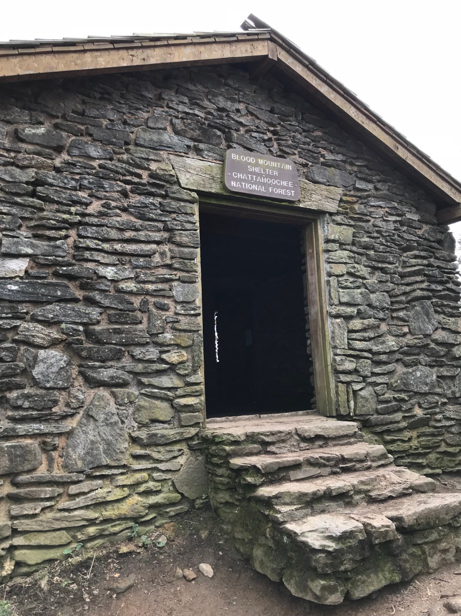
The shelter at the top of Blood Mountain, which you could only stay in if you had a bear canister. I had one, but there was no way I wanted to stay here, especially since my trail friends and I had a cabin reserved at the foot of the mountain.
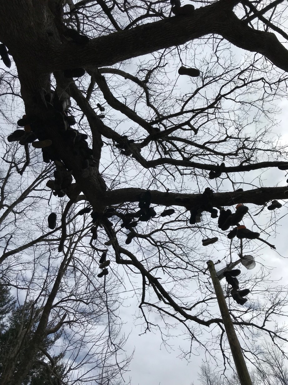
The tree at Mountain Crossings, Neel Gap is strung with castoff boots of the 25% who quit the trail within the first few days. Even though I was ready for a break, there was no way I was quitting this early into the hike.
Monday, April 9 – ZERO DAY (called a zero day because I covered zero miles.) A zero day is sometimes essential for morale, in order to eat a filling meal and do laundry, restock, and enjoy some time to rest and heal before getting back on the trail.

My feet were not bad, but I owe everything to the KT tape and being able to wear my Xero shoes when the boots were too much.
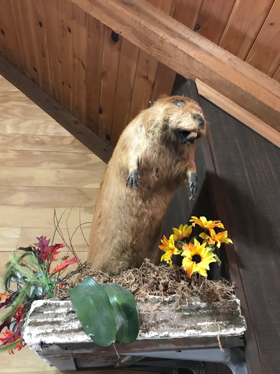
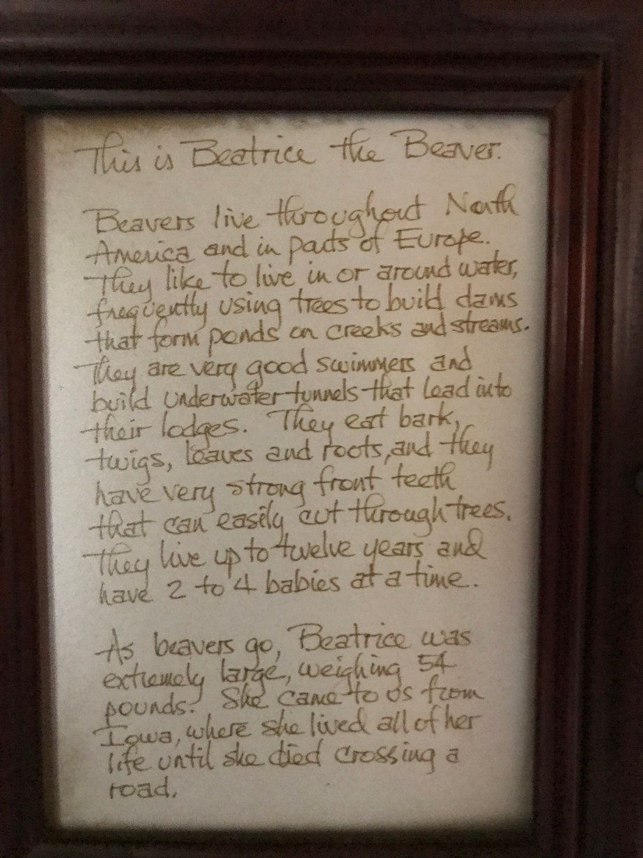
Beatrice the Beaver, mascot of Cabin Beaver, where my hiking friends and I landed for a much needed zero day. Her story is offered below:
Remnants, such as the Appalachians in North America, the Scottish Highlands, and the Atlas Mountains still exist, and since 1994, proponents have argued for the concept of an International Appalachian Trail (or Sentier International des Appalaches) that seeks to “reunit[e] what oceans are dividing.”
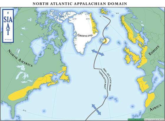
In fact, on the IAT’s website, one reads that, “At the 2012 IAT Annual General Meeting in Reykjavik, Iceland, the Iceland Touring Association’s Kjalvegur hinn forni (Old Kjalvegur hiking trail) became an official part of the International Appalachian Trail.”
As a native Appalachian and someone attempting to hike the “entire” Appalachian Trail from Georgia to Maine, I am perplexed. How is it that this internationally recognized trail is being expanded to include Iceland, a 20 million year old volcanic island along the Mid-Atlantic Ridge? And what does a name, or the identity of a place mean to the people who are from there, or to the people who come as tourists? How far back in time do we go to understand our global citizenry?

When I visited Iceland in the summer of 2017, I fell in love with the people, the culture, the horses, but especially the landscape. Being just one of the 2 million tourists projected to visit Iceland in 2017, I was immediately drawn to questions about belonging, both in terms of who belonged in Iceland and to what extent a place belongs to the people who have an interest in being there.

As a resident of a land where 3 million people from all over the world come annually to hike a trail running through the American region known as Appalachia, I am mystified by the suggestion that we could extend the name of this complex, misunderstood, and historically impoverished region to trails in Iceland and Europe.
My project brings together two geographically isolated regions, Appalachia and the Icelandic Highlands, by exploring the way place and identity are shaped by geologic time and personal experience, while also asking critical questions about tourism’s effect on local economies and fragile landscapes.
I use the word “fielding” to describe my process of exploration; a field is an area of knowledge but it is also a physical space that can be passed through. A field can be inhabited or grazed; it can also be fenced in, commanded, or closed off. A field is a place where boundaries are formed and also trespassed.
As a hiker, I pass through many fields, and so too as an essayist. Most importantly, a field is open to those inside, and though it may be symbolically or literally an enclosure, its edges are sometimes defined only by line of sight or some subtler vision.
My fieldings have usually happened on the page, excepting those times I have been a tourist in the States and abroad. The land of Central Pangea is invisible without both kinds of fielding; we can only see it if we allow geology to draw the lines of our earth’s histories. We recognize that politics and time draw different lines to describe the lives of human beings. Massimo Pietrobon’s world map of Pangea becomes a field into which we enter, now aware of how close we are to people who seemed so far away three minutes ago.


My intent is to see Central Pangea from as many fields as possible. After exploring the culture of thru-hiking on the Appalachian Trail, I intend to travel to Iceland to hike Kjalvegur hinn forni (Old Kjalvegur), then Laugavegur, and ride horses through the wilderness of the highlands during the summer of 2020. From there, an imagined center point, perhaps I will one day explore the rest of these mountains on both sides of the Atlantic.
My project is important because both the Appalachian Mountains and the Icelandic Highlands are vulnerable and also valuable; these are qualities that invite unintentional exploitation by the very people who come from all over the world to enjoy them. I believe that promoting awareness begins with immediate observation and study, in-depth and first hand.
At home in the United States, I am a backpacker and abide by the principles of Leave No Trace, which means that visitors to any natural place must work to protect the land by packing everything out, minimizing damage due to traffic, and being respectful of the residents, both human and nonhuman. Unfortunately not all visitors follow this ethic, and like many other people, I wonder about the hidden cost of Iceland’s tourism explosion, and how it fits into the larger framework of globalization.
Professionally, I am a writer and professor of creative or literary nonfiction. I traveled to Iceland in 2017 as a panelist at the NonfictioNow conference, hosted by the University of Iceland in Reykjavik. I spent two weeks in Iceland, and explored a little outside of the city, riding horses and getting to know more about the land and the people who live there. I was particularly curious about the surge of tourism generated by the “Inspired by Iceland” public relations campaign nearly a decade ago.
As a native of Appalachia, I feel qualified and compelled to consider my own questions about place and identity created by the imagining of the so-called “International” Appalachian Trail which includes areas of Iceland, Scotland, and mainland Europe. I have taught Appalachian literature and presented at a conference for Appalachian Studies. I feel that I have a solid grasp of what Appalachia is in contrast to the rest of America, an understanding of the region’s etymological origin, and I can say without hesitation that the concept of using the word “Appalachian” to describe a trail on the other side of the ocean seems like appropriation, though derived from the nomenclature of mountain building (orogenies) in geology. From what fields do we speak when we name a place?
In the same way that Icelanders marvel at the ridiculous assumptions that tourists make about Iceland, people in my part of the country shake their heads over what people believe about Appalachia. Some of it is true—there is much poverty and ignorance that comes with geographic isolation. But, as is true in Iceland, the strength and resilience of a people who have lived in an isolated place for generations is often obscured by myth. Do cousins marry cousins in Appalachia and do we wear shoes? Are there still outhouses and do people live in cabins? One may as well ask if there is an app to prevent Icelanders from marrying relatives, and whether everyone there believes in elves.
Iceland, at 39,682 mi², is slightly larger in area than the Blue Ridge Mountains, the part of Appalachia I call home, estimated to be 34,563 mi². The two National Parks in the Blue Ridge area are Shenandoah and the Great Smoky Mountains, which combined drew over 12.5 million visitors in 2016. As with Iceland’s Ring Road and Golden Circle, visitors from all over the world primarily see the landscape of these parks by car, either via Skyline Drive or the Blue Ridge Parkway. This comparison is useful for my project because how a landscape is experienced affects how the environment is preserved. Given the number of tourists now coming to Iceland, the people there are having to find new ways to manage resources that natives and non-natives share. Although tourism is a boon to places that offer natural wonders, what is the final cost for the people who make their homes there?
Tonally, my hopes are that I can approach serious concerns with a light-hearted curiosity and a willingness to inhabit this fantasized middangeard, a hypothesized field of geologic time and orogenies without falling into parody. I think it is fruitful whenever we find ways to connect to cultures distinct from our own, and laugh at the folly of naming, of owning, of possessing something as old as our Earth, a place that has been divided, folded, lifted, and imagined in ways surpassing human experience.

